
VANI VILASA SAGARA DAM-(MAARIKANIVE) AND CHITRADURGA-JUNE 2011
 |
Date : 10th, 11th and 12th June 2011
Route : Bangalore-Tumkur-Sira-Hiriyur-(150 Kms)
Hiriyur to Vanivilasa Sagara DAM(17 Kms) -
Hiriyur to Chitradurga (40 Kms)
and Back to Bangalore
Hiriyur to Vanivilasa Sagara DAM(17 Kms) -
Hiriyur to Chitradurga (40 Kms)
and Back to Bangalore
The TEAM
Sateesh N (Myself)
Ananth Kaskar
Promod Solomon
Lokesh
Kumara Swamy J
Harsha AS
 |
| L-R : Promod,Kumar,Lokesh,Harsha and Ananth |
TOUR REPORT
The team of Karnataka Government Secretariat Cricketers after finishing their League Matches organized by KSCA are eagerly waiting to go out to refresh their body. As we decided to plan an outing the first instance it was decided to move on to Bheemeshwari Nature Camp as it was too nearer to Bangalore, again decided to change the venue to Bhadra and Gajanur as we could not get accommodation, finally decided the destination to Vanivilasa Sagara Dam and JogiMatti at Chitradurga, Promod had a talk with this friend Nandish who is working at AC, Office, Chitradurga that we are planning to visit your place, please look into make arrangements to stay, he arranged to reserve the rooms and VaniVilasa Sagara Dam and the tour begins
10th June 2011 :
Left Bangalore at 3-30 pm from Yelahanka-Jalahalli-Nelamangala, as no one had lunch had a lunch at Petrol bunk near Nelamangala and also had petrol to the Vehicle. Reached Hiriyur by 6-00 pm, One Mr. Manjunath who was friend of Mr. Lokesh was informed to have a cup of tea at his residence in Hiriyur, after light tea and snacks we moved to Vani Vilasa Pura which is 17 kms from Hiriyur. We reached VV Pura at 7-30 pm as it was already booked Mr. Rangaswamy Incharge of the IB had given room, we had fresh’n’up and had a Dinner and went to sleep
11th June 2011:
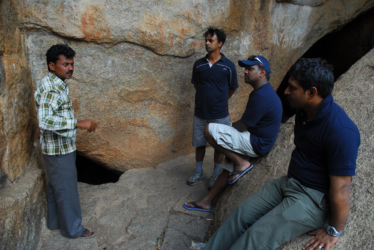
Early morning I woke up at 5-30 am as the sun was coming from the clouds, I and Ananth proceeds towards the DAM site and had a early morning view of the DAM as well as SunRise, it was one the fine views (actually I visited this place in the year 1997), I took some good pics over there and came back had bath and breakfast and decided to move to chitradurga fort, JogiMatt and in and around Chitradurga, as Mr. Lokesh had a back pain, he was stayed back in the room, we five started journey towards Chitradurga reached by 11-30 am near the Fort had Tender Coconut, after taking a Entry Ticket we moved towards the Entry, Mr Swamy the Guide approached us and informed that he would make a Fort Journey through his experience, we decided to have a guide, he took us and explained the each and one important places with his narration, he had good database of all the names who visited the place, Finally the important one we reached Onke Obavva’s Place, to narrated the full story and he took almost 15-20 mts to cover only the One Obavva’s Kindi story, as he was narrating I was clicking the pics of Chamelion nearby, finally had a small lunch over there at canteen eating Puliyogere and Alu Bajji with some tea, Majige etc, and returned back to VV Pura by 5-00 pm had tea, after finishing Tea all the team members visited the DAM Site with a spectacular Sunset view came back to Rooms had dinner went to sleep
12th June 2011:
Early morning lonely, I once again visited the DAM Site and took another round of pics. After finishing Breakfast, settling the accounts, we moved from VV Pura to Hiriyur as instructed earlier by Mr. Manjunath of Hiriyur he had arranged a beautiful Lunch at his residence (Veg and Non-Veg). From there we proceeded back towards our journey to Bangalore and reached Bangalore by 6-00 pm.
Acknowledgements:
Sri Nandish,
Sri Rangaswamy and Sri Shivanna (Cook and Caretaker at VV Pura IB)
Sri Manjuanth (Hiriyur)
And
Finally to Sri Lokesh who is the owner of Vehicle SCORPRIO
And the Drivers of our Team (Sri Promod and Sri Kumaraswamy J) who drove safely
Mari Kanive (Kannada: ಮಾರಿ ಕಣಿವೆ) is a dam near Hiriyur Taluk, Chitradurga District, in the Indian state of Karnataka. It is the oldest dam in the state.
The team of Karnataka Government Secretariat Cricketers after finishing their League Matches organized by KSCA are eagerly waiting to go out to refresh their body. As we decided to plan an outing the first instance it was decided to move on to Bheemeshwari Nature Camp as it was too nearer to Bangalore, again decided to change the venue to Bhadra and Gajanur as we could not get accommodation, finally decided the destination to Vanivilasa Sagara Dam and JogiMatti at Chitradurga, Promod had a talk with this friend Nandish who is working at AC, Office, Chitradurga that we are planning to visit your place, please look into make arrangements to stay, he arranged to reserve the rooms and VaniVilasa Sagara Dam and the tour begins
10th June 2011 :
Left Bangalore at 3-30 pm from Yelahanka-Jalahalli-Nelamangala, as no one had lunch had a lunch at Petrol bunk near Nelamangala and also had petrol to the Vehicle. Reached Hiriyur by 6-00 pm, One Mr. Manjunath who was friend of Mr. Lokesh was informed to have a cup of tea at his residence in Hiriyur, after light tea and snacks we moved to Vani Vilasa Pura which is 17 kms from Hiriyur. We reached VV Pura at 7-30 pm as it was already booked Mr. Rangaswamy Incharge of the IB had given room, we had fresh’n’up and had a Dinner and went to sleep
11th June 2011:
Early morning I woke up at 5-30 am as the sun was coming from the clouds, I and Ananth proceeds towards the DAM site and had a early morning view of the DAM as well as SunRise, it was one the fine views (actually I visited this place in the year 1997), I took some good pics over there and came back had bath and breakfast and decided to move to chitradurga fort, JogiMatt and in and around Chitradurga, as Mr. Lokesh had a back pain, he was stayed back in the room, we five started journey towards Chitradurga reached by 11-30 am near the Fort had Tender Coconut, after taking a Entry Ticket we moved towards the Entry, Mr Swamy the Guide approached us and informed that he would make a Fort Journey through his experience, we decided to have a guide, he took us and explained the each and one important places with his narration, he had good database of all the names who visited the place, Finally the important one we reached Onke Obavva’s Place, to narrated the full story and he took almost 15-20 mts to cover only the One Obavva’s Kindi story, as he was narrating I was clicking the pics of Chamelion nearby, finally had a small lunch over there at canteen eating Puliyogere and Alu Bajji with some tea, Majige etc, and returned back to VV Pura by 5-00 pm had tea, after finishing Tea all the team members visited the DAM Site with a spectacular Sunset view came back to Rooms had dinner went to sleep
12th June 2011:
Early morning lonely, I once again visited the DAM Site and took another round of pics. After finishing Breakfast, settling the accounts, we moved from VV Pura to Hiriyur as instructed earlier by Mr. Manjunath of Hiriyur he had arranged a beautiful Lunch at his residence (Veg and Non-Veg). From there we proceeded back towards our journey to Bangalore and reached Bangalore by 6-00 pm.
Acknowledgements:
Sri Nandish,
Sri Rangaswamy and Sri Shivanna (Cook and Caretaker at VV Pura IB)
Sri Manjuanth (Hiriyur)
And
Finally to Sri Lokesh who is the owner of Vehicle SCORPRIO
And the Drivers of our Team (Sri Promod and Sri Kumaraswamy J) who drove safely
INFORMATION ABOUT PLACES WE VISITED
Mari Kanive (Kannada: ಮಾರಿ ಕಣಿವೆ) is a dam near Hiriyur Taluk, Chitradurga District, in the Indian state of Karnataka. It is the oldest dam in the state.

The dam was built by the Mysore Maharajas pre-independence across the river Vedavathi. The dam is an exquisite piece of architecture, an engineering marvel for that time, and provides water to lots of surrounding cities, towns and villages, which are largely dry lands of the Deccan area of Central Karnataka.
History

The dam was constructed by a team led by an Engineer called 'Tara Chand Dalal' at the order of his Highness the Maharaja of Mysore Sri Krishnaraja Wodeyar IV.


This dam is the source of domestic water for Hiriyur and Chitradurga. It irrigates more than 100 km² of land in Hiriyur and Challakere taluks through right and left bank canals. This place is 160 km from Bangalore on the NH-4 highway and 40 km from Chitradurga. For the construction of this dam royals of mysore had to pledge royal jewellery due to shortage of money,that is why it was named as "vanivilasa sagara".vanivilasa was the name of youngest daughter of the then maharaja of mysore.mari kanive is the oldest and biggest man made reservoir in asia.This dam is higher than KRS dam of Mysore.


 |
| Two Members Serious about DAM, Another Two keenly interested to give a pose |

 |
| SunSet View with a colourful Clouds |

 |
| Enjoying the View of Sunset at VV Sagar DAM |
The dam has been a tourist attraction for many years, but has been apparently neglected as a prime tourist destination. Recently, though, the development work undertaken by the forest department to restore the nearby forest cover, and the 'panchavati' gardens-a garden of medicinal plants with the old Indian cultural theme has improved the tourist figures, making it a popular weekend picnic spot. The 'panchavati' garden has medicinal plants lined up representing cultural themes - the 'Rashis', 'Sapta swaras', 'Nava grahas' and many more. The tourists who visit Chitradurga and Hosdurga often visit Mari kanive on the way. The historic maarikaamba temple here also attracts many tourists. The place is around 20 km drive from Hiriyur on a deviation from NH4 (Bangalore - Mumbai National Highway).
(Source: Wikipedia)
 |
| Inspection Bungalow at VV Pura |
CHITRADURGA

Built 18th century
Built by Nayakas of Chitradurga
Construction materials Granite Stones
Current condition Ruins
Open to the public Yes, Controlled by Government of Karnataka
Battles/wars Nayakas against Hyder Ali in 1760s, 1770s & 1799

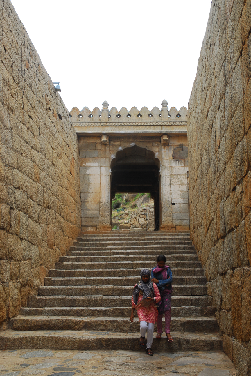
Chitradurga Fort (Kannada: ಚಿತ್ರದುರ್ಗದ ಕೋಟೆ), or as the British called it Chitaldoorg, straddles several hills and a peak overlooking a flat valley in the Chitradurga District, Karnataka, India. The fort's name Chitrakaldurga, which means 'picturesque fort' in Kannada, is the namesake of the town Chitradurga and its administrative district.


Chitradurga Fort lies in the midst of a valley formed by the Vedavati River. The Tungabhadra River flows to the northwest of the Fort. Seven hills constitute the Chinmuladri range. The seven circles of the fort enclose these hills. Features of massive rock hills and scenic valleys, huge towering boulders are seen in the fort precincts. The hills on which major part of the fort and the city rest, belong to the oldest rock of granitic formation in the country. The highest hill peak of the area is located at Jogi Matti, 5 kilometres (3.1 mi) to the south of Chitradurga. The highest elevation of the hills at the fort is 976 metres (3,202 ft).[5] The area covered by the fort is reported to be 1,500 acres (607.0 ha).
The fort is located 120 km (74.6 mi) from Hampi, the UNESCO World Heritage Site and 200 km (124.3 mi) from Bangalore. The nearest railhead is Davanagere on the Bangalore/Mysore – Arasikere broad gauge railway line.
History
 |
| Gombe Mantapa |
 |
| Thaneer Konda |
Timmana Nayaka or Thimmappa Nayaka, a chieftain from Matti in Davangere taluk, during the rule of Saluva Narasimha, was the first ruler in the hierarchy of the Nayakas of Chitradurga. Initially, he was a chieftain under the Vijayanagar Empire but was soon elevated to the rank of Governor of Chitradurga by the Vijayanagar ruler in recognition of his excellent provence in military service to the empire. His rule covered areas of the Davangere district and Chitradurga district. His rule lasted for a brief period and ended with his incarceration and death in the jail of the Vijaynagar Empire. After him, his son Obana Nayaka or Madakari Nayaka (1588–1602) succeeded him. Madakari Nayaka was followed by a series of hierarchical or other adopted forms of successions of the same clan; Madakari Nayaka V was the final ruler of the clan from 1758 to 1779. Bharamappa Nayaka who ruled from 1689 till 1722 is regarded as the greatest of the Nayaka rulers famed for building forts, palaces, tanks and temples, including several gateways and bastions. He fought several battles against the Mughals.

However, it was during the reign of Madakari Nayaka V (1758 to 1779) that the city of Chitradurga and the Fort were besieged by the troops of Hyder Ali. Madakari Nayaka used the fort effectively for defense during three battles that were fought against Hyder Ali. At times he had allied himself with Hyder Ali of Mysore Kingdom and at other times with the Marathas. Hyder Ali attacked the Chitradurga Fort first time in 1760, the second time in 1770 and the third time successfully in 1779 when he defeated Madakari Nayaka. Madakari Nayaka was taken a prisoner and killed. Nayaka's gamble of playing with both Hyder Ali and the Marathas did not work out. He was betrayed by the Marathas and some local Muhammadan officers in his service. Subsequent to his death the treasury at the fort is said to have yielded a rich bounty. It was during one such war that the heroics of Onake Obavva, the wife of a soldier guarding the fort became a legendary event.

 |
| Two men holding and Two pulling pushing the hill (Mr Hercules and Gang) |
In the Fourth Mysore War, Tippu Sultan was killed by the British in 1799, and the Mysore Kingdom was reordered under the Wodeyars. Chitradurga became a part of Mysore province. The British considered Chitradurga Fort a potentially useful base for providing a strong line of defense to Mysore's northern border. Between 1799 and 1809, the British garrisoned their troops in the fort. Later, the control of the fort was restored to the Government of Mysore.
Brave woman

 |
| Guide Narrating the history of Onake Obavva near Obavva's Kindi |

Temples in the fort
 |
| Venugopal Swamy Temple |
Entrance to Hidimbeswara Temple. Hidimba and Hidimbi are stated to have lived here
Eighteen temples were built in the upper fort. Some of the well-known temples were: the Hidimbeswara (an ancient legend is linked to it), Sampige Siddeshwara, Ekanathamma, Phalguneshwara, Gopala Krishna, Lord Hanuman, Subbaraya and Nandi


Hidimbeswara temple displays the tooth of Hidimba, the giant (Rakshasa in Sanskrit). It is said that Hidimba and his sister Hidimbi, a giantess, used to live in this temple. Hidimbi, who fell in love with Bhima (the second of the Pandava brothers of Mahabharata) married him and had a child by him named Ghatotkacha. A large cylinder about 3 metres (9.8 ft) in circumference and 2 metres (6.6 ft) high made of iron plates known as Bheri or Drum of Bheema is also located here. A monolithic pillar and two swing frames are also seen at the gate to this temple. Sampige Siddheshvara temple can be seen at the foot of the hill. In the Gopalakrishna Temple, inscriptions date the idol to the early 14th century.
In the lower fort, a temple dedicated to the tutelary deity of the Nayaka Palegars, the Uchchangiamma or Uthsavamba, was built, amidst the rocks of the fort complex on the hill
The Murugarajendra Matha, a famous religious institution of the Lingayats, which was originally located within the fort, is now situated about 2 kilometres (1.2 mi) to the northwest of Chitradurga]
Other structures

Historical linkage has been established by an archeological inscription dated 1284 AD found in the Panchalinga (Five Lingas) cave in the Ankhi Matha area, to the west of Chitradurga. The inscription attributes the establishment of the Five Lingas, (aniconic symbols of Lord Shiva), to the Pandavas. At Ankhi Matha, approached by stone steps, a series of ancient subterranean chambers cut out at different levels are seen, in addition to several places of worship and platforms
In the lower fort, a Cutcherry (Administrative office) was added during Tippu Sultan’s rule. Another interesting find in the arsenal is a quadruple mill made of masonry of 3 metres (9.8 ft) depth and about 7 metres (23 ft) dia, which is inferred as a device used for preparing gun powder during Hyder Ali and Tippu Sultan’s rule. In Kannada language, it is called 'Maddu Bisuva Kallu', which means "Gun Powder Grinding stone". The quadruple mill has four massive grinders with teeth or slots. These were rotated either by elephants or bullocks (in a central circular space) with independent collection point for each of the four slots to collect the explosive gun powder.
 |
| Palegarara Kacheri (Office of the erstwhile Palegars) |
 |
Inside view of Palegaar's Kacheri I found this Macaque, (Monkey) near the Fort (Just besides Onake Obbava's Kindi, it was trying to get the Empty Slice Drink Tetra Pack from the Dust Bin. and he did not know to drink, he was trying i clicked all the below fotos |


